Educational Equipments Manufacturer, Exporters & Suppliers - School Educational Equipments Manufacturers & Exporters of Educational Equipments for Lab. Science Lab Products, Teaching Aids, Classroom Instruments, Educational Laboratory
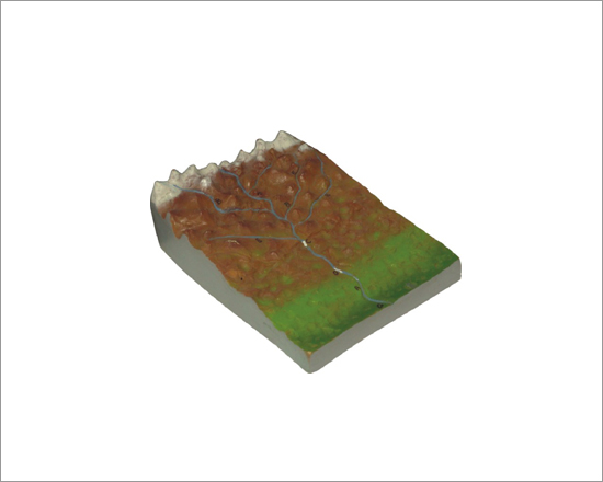
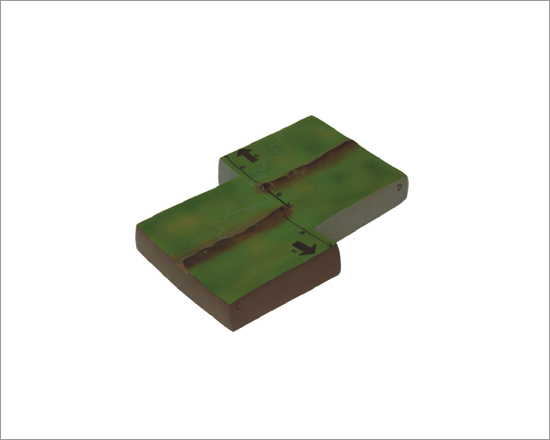
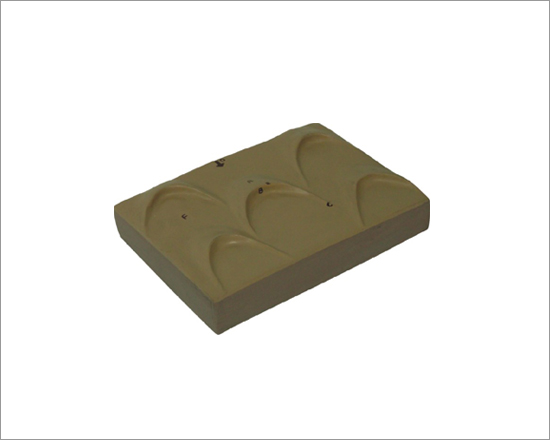
GEOM0001 - Collecting River System
Collecting river system consists of a network of tributaries in the headwater region. V-shaped valleys, interlocking spurs, rapids, waterfalls and gorges are features associated with it.
Size: 25x25 cm
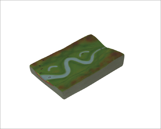
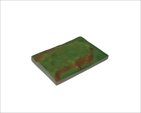
GEOM0005 - Transporting River System
Main trunk stream system of water and sediment movement from collecting system towards dispersing system. Meanders, oxbow lakes and levees are features associated with it.
Size: 25x25 cm
GEOM0009 - Ice Sheet and Icebergs
An ice sheet is a mass of glacial land ice extending more than 50,000 square kilometers. An ice shelf is the floating extension of the ice sheets. The primary mechanism of mass loss from ice shelves is iceberg calving.ing spurs, rapids, waterfalls and gorges are features associated with it.
Size: 25x25 cm
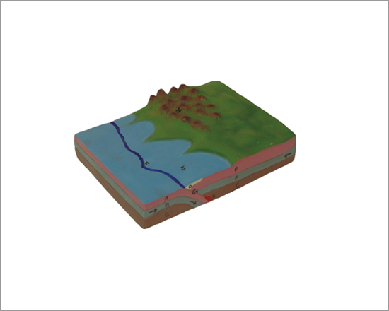
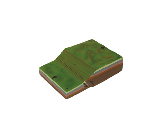
GEOM0013 - Convergent Plate Boundaries
Convergent plate boundaries, also known as destructive plate boundaries are zones where lithospheric plates collide. Magma is generated at subduction zones.spurs, rapids, waterfalls and gorges are features associated with it.
Size: 25x25 cm
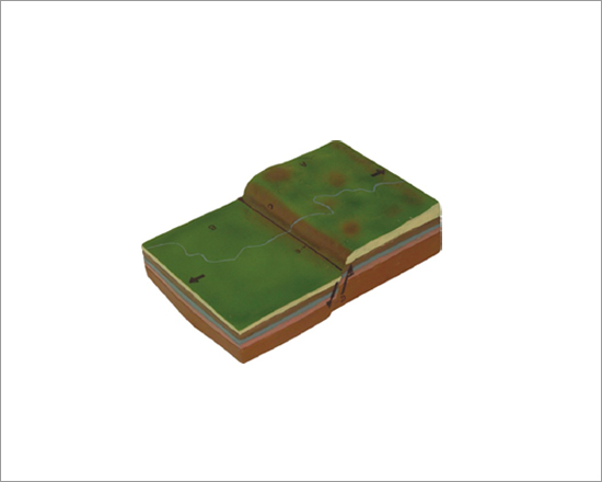
GEOM0017 - Divergent Plate Boundaries
Divergent plate boundaries, also known as constructive plate boundaries are zones where lithospheric plates drift from one another.
Size: 25x25 cm
GEOM0021 - Transform Plate Boundaries
Transform plate boundaries move horizontally past each other on strike-slip faults. Lithosphere is neither created nor destroyed.
Size: 25x25 cm
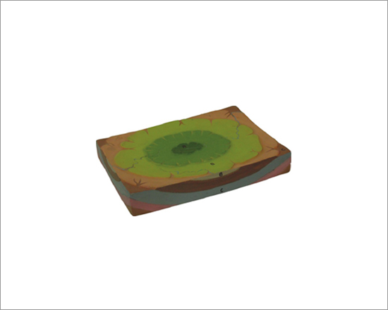
GEOM0025 - Structural Basin
A structural basin is a large-scale structural depression of rock strata formed by tectonic warping of previously flat lying strata. The exposed strata in a basin are progressively younger from outside-in, with the youngest rocks in the center.
Size: 25x25 cm
GEOM0029 - Plateau
A plateau is an area of highland, usually consisting of relatively flat terrain. The essential criteria for plateaus are low relative relief and some altitude.
Size: 25x25 cm
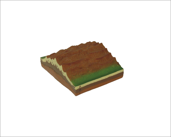
GEOM0033 - Fold Mountains
Mountains formed mainly by the effects of uplift and folding on layers within the upper part of the Earth's crust. Fold Mountains are usually formed from sedimentary rocks.
Size: 25x25 cm
GEOM0037 - Normal Fault
In normal fault, the hanging wall block moves down relative to the footwall block. Normal faults are associated with crustal tension.
Size: 25x25 cm
GEOM0041 - Reverse Fault
In reverse fault, the hanging wall block moves up relative to the footwall block. Reverse faults are associated with the crustal compressions.
Size: 25x25 cm
GEOM0045 - Anticlines and Synclines
Collecting river system consists of a network of tributaries in the headwater region. V-shaped valleys, interlocking spurs, rapids, waterfalls and gorges are features associated with it.
Size: 25x25 cm
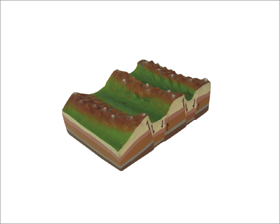
GEOM0049 - Horsts and Grabens
Collecting river system consists of a network of tributaries in the headwater region. V-shaped valleys, interlocking spurs, rapids, waterfalls and gorges are features associated with it.
Size: 25x25 cm
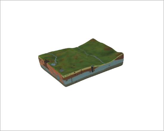
GEOM0053 - Groundwater
Water located beneath the ground surface in soil pore spaces and in the fractures of rock formations. Ground water can be obtained by drilling or digging wells.
Size: 25x25 cm
GEOM0057 - Sand Dunes - Barchans
A barchan dune is an arc-shaped sand ridge, comprising well-sorted sand. Barchans are the commonest types of dunes occurring in sandy deserts.
Size: 25x25 cm
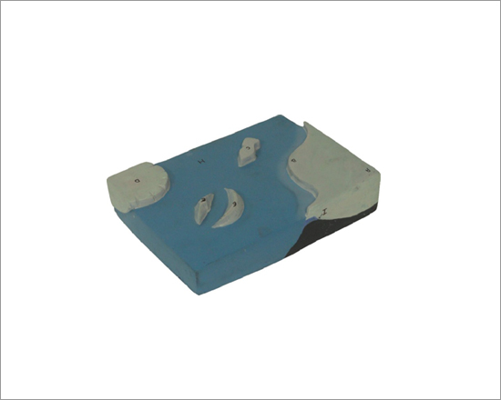
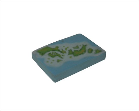
GEOM0061 - Archipelago
An archipelago is a chain or cluster of islands. Archipelagos may be found isolated in bodies of water or neighboring a large land mass.
Size: 25x25 cm